New Safety Video for Popular Franz Josef Day Hike
Media Release
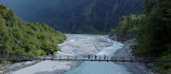
Following ongoing search and rescue incidents, NZ Mountain Safety Council (MSC), in partnership with the Department of Conservation (DOC), has produced a safety video for Roberts Point Track. The popular but challenging day hike climbs up the Waiho Valley for spectacular views of Franz Josef Glacier.
The track has the highest number of rescues in Westland Tai Poutini National Park. Between 2013 and 2026, 27 people had to be rescued on the track, and three people died over 2011 and 2012.
Many New Zealanders and international visitors are drawn to Roberts Point Track for the chance to see Kā Roimata o Hine Hukatere/Franz Josef Glacier. However, some don’t realise that this is an advanced track within a dynamic environment, and requires appropriate skills, fitness and gear."– MSC Chief Executive Mike Daisley
Accessible all year round, the 12.3 km return trip is graded advanced and takes between 5 to 6 hours to complete. It involves a steep climb, with rough, uneven and often slippery terrain, and unbridged creek crossings. The weather can change quickly in this area and heavy rain is common, causing creeks to rise rapidly.
MSC worked with DOC South Westland, as well as local Police and Land Search and Rescue New Zealand (LandSAR) volunteers, to understand where people were getting into trouble on the track.
“We used local knowledge with our own insights to gain a picture of the decisions and behaviours that often lead to safety incidents on the track," says Daisley. “We found, for example, that people were underestimating the track conditions, continuing on despite deteriorating weather or leaving the marked route.”
The new safety video, which builds on MSC’s established tramping video series, helps people understand what to expect, know how to prepare, and make good decisions during their planning and when out on the track.
"The video highlights the key hazards and decision-making points along the track, while reinforcing simple but important safety messages such as checking the weather forecast, carrying the right clothing and gear, and knowing when to turn back,” says Daisley. “It's designed to help people be well prepared and enjoy a safer trip."
Viewers are also reminded that the descent back to the carpark is just as demanding as the climb up to see the glacier.
“Many injuries happen on the return trip, when people are tired, the finish is in sight and people’s concentration starts to slip,” says Daisley. “We’re reminding people to stay together, watch your footing on the track and make considered decisions around creek crossings, especially if water levels have risen."
DOC Franz Josef Operations Manager Wayne Costello says people should be realistic about their experience and the conditions before committing to the trip.
“Roberts Point is a spectacular track with outstanding glacier views, but it is an advanced tramping track and is not suitable in all conditions. People need to check the weather forecast, and be prepared to change their plans if conditions aren’t right," Costello says.
“We recommend starting early to give yourself plenty of daylight to complete the trip. An early start can also improve your chances of seeing the glacier before afternoon cloud develops. Most importantly, never be embarrassed to turn back. Conditions can change quickly, and deciding to turn around is often the safest choice.”
Working in partnership with DOC, and local Police and LandSAR, has been critical to the success of the safety initiative.
"This project is a great example of what can be achieved when organisations work together,” says Daisley. “By combining national insights with local knowledge and experience, we've created a practical resource that's grounded in real-world experience and gives people the information they need to make safer decisions."
For those who decide Roberts Point Track is not suitable, there are plenty of other options in the area that offer a rewarding day out, including Alex Knob Track and Lake Gault Track.
Roberts Point Track key safety advice
- Ensure you have the skills and fitness: Before committing to this track, research the route and make sure it is suitable for everyone in your group.
- Check the weather: Creeks on the track can become impassable following heavy rain. If rain is forecast, reschedule your trip.
- Take the right gear: Wear sturdy footwear, and pack warm clothing, a warm hat, gloves, a waterproof jacket, an emergency shelter, extra food, and an emergency communication device, like a personal locator beacon.
- Stay on the track: Follow the orange track markers. There may appear to be other paths, but the marked track is the only safe way.
- Turn back if conditions change: If the weather deteriorates, the creeks are unsafe to cross or the track is harder than you expected, return to the carpark.
Get all the information you need to plan a safe trip on Plan My Walk, including official track alerts, weather forecasts and warnings, and useful reviews from other walkers. Before you go, check with DOC’s Westland Tai Poutini National Park Visitor Centre for the latest track and weather conditions, and expert advice.
PHOTO CREDIT | NZ Mountain Safety Council | Roberts Point Track
Last edited: August 2026