Know how to use your map?
Knowing how to find your way in New Zealand’s terrain is essential. While it’s important to do your track research before you leave home, knowing how to use a physical map while you’re out on the track is just as important.
One of our Partnership Advisors, Adam Smith, has years of experience navigating in New Zealand’s great outdoors. Here are five tips on navigating using a physical map from Adam:
- Keep your paper map accessible.
Have the map folded, in a plastic or waterproof bag in a side pocket of your pack, showing the area you’re exploring so it is easy to access and quick to use. - Check the map regularly.
Refer to the map at least once an hour. Assess the terrain around you and compare it to the map’s features. (Tip: Even on a well-graded track you will travel about 4km per hour, so it is easy to cover a reasonable amount of ground in a short time). - Measure your pace count.
Before heading out on the track know what your pace count is across 100m (how many times your left foot hits the ground). It’s good to know this for flat easy ground and on rougher, more challenging terrain, as the count will be different. This will help you to keep track of how far you’re going and will help you to measure distance from a fixed point. - Know what a fixed point is.
A fixed point is a physical feature that won’t move and that can be found on a map, such as a bridge, track intersection, hut or a fork in a river or stream. Over the course of you tramp you’ll link up numerous fixed points, these are great features to confirm your location. - A limiting feature.
This is a feature that you physically cannot pass without missing it, such as a river or a ridgeline. It’s best to identify a limiting feature on the map when you begin for the day, or after breaks, as a reference so when you reach it you know you may have gone too far. Adam says that regardless of the track, whether it’s well-formed or not, staying up to date with your location and the route ahead is crucial.

“It’s easier to keep track of where you’re going if you maintain that knowledge regularly, rather than having to stop and figure it out where you are each time."
“Even with well-formed tracks it’s important to keep up with this and follow yourself on a paper map, if nothing else because it’s good practice associating the terrain to your map."
There are many benefits of using a paper map and the above five tips.
“You will save battery time on your device and it encourages you to interact with nature and stay in touch with the weather, and it also helps you to understand the environment you are in. It is also good to converse with the group about this, keeping everyone informed, and making decisions together.”
Where to next?
- Get your paper map for your trip from your local tramping or hunting store. You can start searching for the map of your choice on LINZ’s Map Chooser or find a map retailer
- Learn more about Navigation skills and try out our E-Learning Tool
- You can also dive into the navigation section of our Bushcraft Manual
- We also have videos on Using a Compass, Reading a Map and Finding a Bearing in our How-to Get Outdoors Series.
If you have tips on navigation for NZ’s outdoors, get in touch – the more shared, the more others can learn. Email Rebekah.Wilson@mountainsafety.org.nz
HEADER PHOTO/ Jo. Stilwell
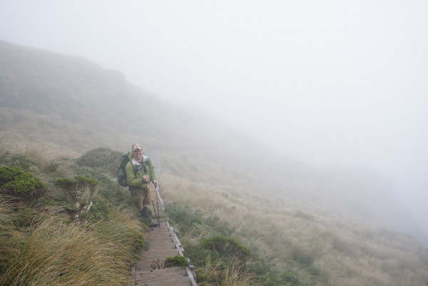
Photo: Partnership Advisors Adam Smith tackling the Taranaki Summit Route. PHOTO/SUPPLIED.