River Safety: Learn the Skills for These Classic Tramps
To mark River Safety Month in October, we highlight five spectacular South Island tramping tracks where you’ll need solid river safety skills. When in the great outdoors, treat every creek, stream and river with extreme caution. If you don’t yet have river crossing skills, stick to tracks with bridges until you do. Remember the rule of thumb: if in doubt, stay out.
Greenstone and Caples Track, Otago
This 60 km, 4-day loop track traverses the picturesque Greenstone and Caples valleys. You’ll wander through beech forest, cross tussock flats (where you might spot a takahē) and follow vibrant blue-green rivers. The valleys are linked by the subalpine McKellar Saddle, where conditions can change suddenly.
Heavy rain is common here, and rivers and side streams can rise quickly, making river crossing skills essential. There are five huts to stay along the way, which need to be booked in advance.
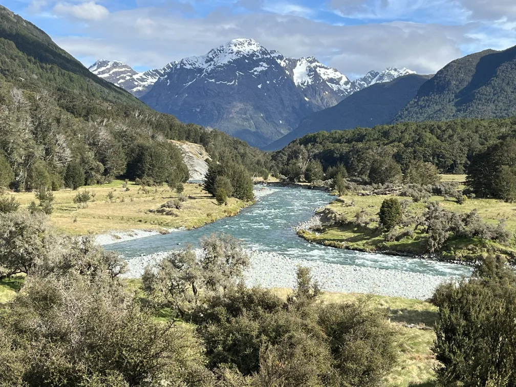 PHOTO CREDIT | Bruce-Corney, Plan My Walk| Greenstone Caples Track
Gillespie Pass Circuit, Otago
Follow the Young River valley over Gillespie Pass on this 56 km, 3–4 day advanced loop track. A side trip to the glacial Crucible Lake is highly recommended – allow an extra day for this from Siberia Hut. The track involves crossing the Young and Makarora rivers as well as numerous streams.
While the Makarora River crossings can be avoided by booking a jet boat ride in advance, trampers still need strong river crossing skills and should be prepared in case the rivers or streams become impassable. Carry an emergency shelter, an extra meal and an emergency communication device in case you can’t cross and need to wait it out.
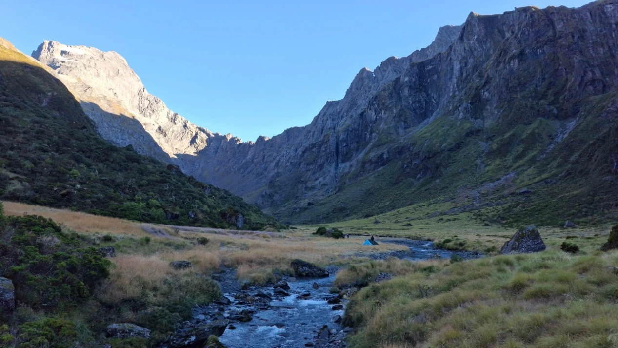
PHOTO CREDIT | Lachlan McKenzie, Plan-My-Walk | Gillespie Pass Circuit
Rees–Dart Track, Otago
This advanced track covers 63 km in 4-5 days with highlights including mountain views, alpine flora and glacier-fed rivers. There are numerous river and stream crossings that can become hazardous in heavy rain or snow melt, particularly in spring. Only attempt this track between late November and the end of April as the upper Snowy Creek Bridge is removed in mid-May until late spring/early summer, due to significant avalanche risk.
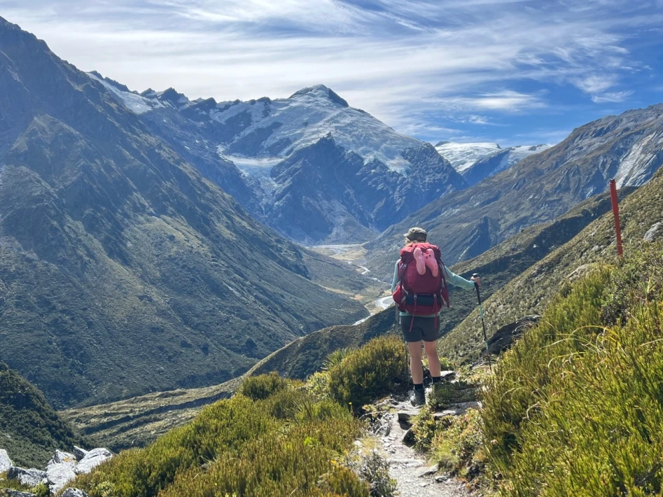
PHOTO CREDIT | Gabriela M, Plan My Walk | Rees-Dart Track
Richmond Alpine Route, Tasman
Part of Te Araroa, this 96 km route is a notoriously challenging 5-7 day tramp. Expect gruelling climbs above 1,500 m, rocky paths with steep drop-offs and alpine conditions. If you’re highly skilled and experienced, the unique alpine environment offers plenty of rewards.
The track requires numerous stream crossings which can become impassable in bad weather. Know the signs of an unsafe river and don’t cross if conditions aren’t safe. There are 7 huts along the way.
Copland Track to Welcome Flat Hut, West Coast
This 18 km track to Welcome Flat is famous for the hot pools and views of the Sierra Range. It’s about 7 hours’ walk to the hut and then just a short stroll to the pools.
Despite this drawcard, the route is for experienced and well-equipped trampers only. The track has 10 creek crossings, beginning with Rough Creek at the start of the track.
The valley is subject to flooding at any time of year and the creeks can rise quickly after rain. Do not attempt this trip in bad weather or when rain is forecast.
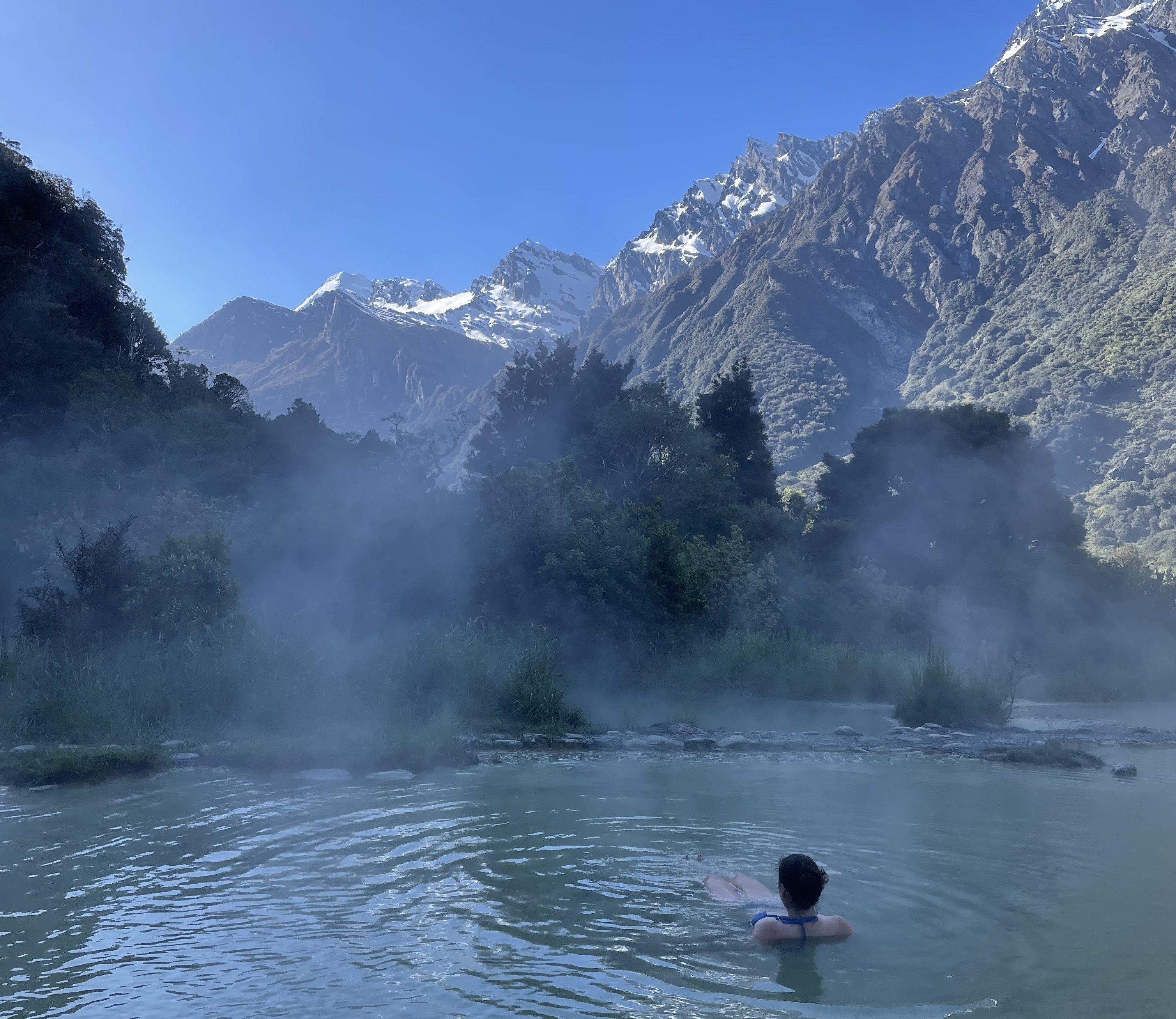 PHOTO CREDIT | Pippa Halliday, Plan My Walk | Welcome Flat hot pools
Know the Signs of an Unsafe River
MSC has developed a simple four-step guide to help spot the signs of an unsafe river. When faced with a river crossing, take time to ask these quick questions and discuss them with your group. If you answer yes to any of these questions, don’t cross.
- Too fast? Is the water moving faster than normal walking pace?
- Too murky? Is the water brown and dirty?
- Too messy? Is the water carrying items, like trees or branches?
- Too loud? Are there loud noises, like roaring water or moving rocks?
These signs all indicate that the river is in flood and should not be crossed.
Find Out More About River Safety
- River safety skills | Learn the basics
- Know how to cross | Watch our river crossing safety video
- Get the training | Find a river crossing course
This article was first published on stuff.co.nz
PHOTO CREDIT | Lachlan McKenzie, Plan-My-Walk | Gillespie Pass Circuit